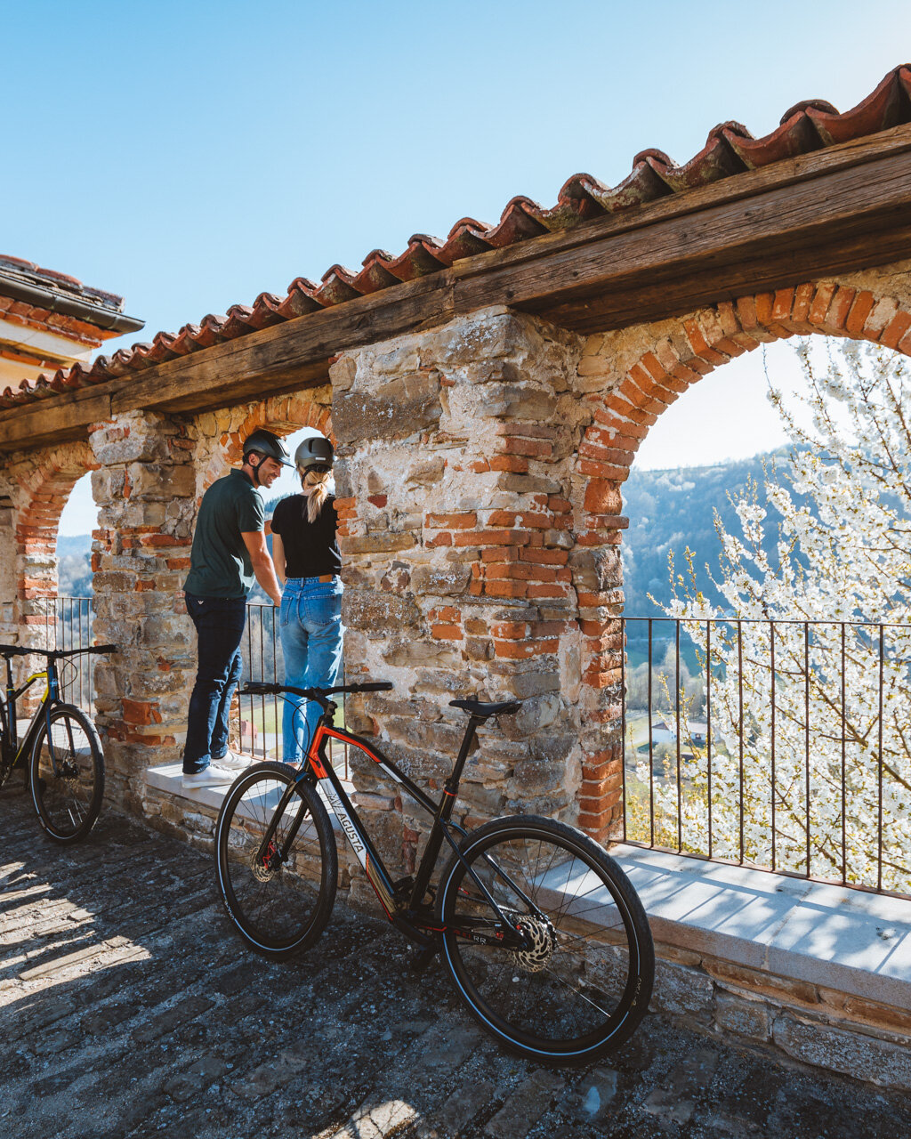
The Municipality of Tigliole has developed throughout its territory a series of loop hikes of different lengths ranging from 6 to 21 kilometres so that each person can choose according to their physical abilities. The Yellow Route suggested here is actually part of all six routes traced by the Municipality, the path is well marked with embossed signs featuring the name "Tiglieto".
- suitable for: children aged 6 or above
- not suited to strollers (younger kids should be carried in a backpack)
- elevation gain: +250 metres overall
- distance: 10 km overall
- estimated time: 3,30 hours
- route type: loop on asphalt, dirt road, footpath
- starting altitude: 240 metres
- minimum altitude: 140 metres
- when: spring, autumn, low-snow winter
You start your walk from the car park located near the Town Hall of Tigliole, situated in a dominant position on the site of an ancient castle that has now completely disappeared. In the neoclassical building there is a permanent contemporary art exhibition which can be visited during municipal offices opening hours.
Opposite the façade, take the pedestrian descent to the right, marked by memorial stones that commemorate the casualties of the Great War and reach the 19th century church of the Holy Crucifix which today, oddly enough, is home to a bank. You cross the square to go towards the Monument dedicated to the Alpines and walk by the 17th century parish church dedicated to Saints Giovanni and Lorenzo, then continue along the Provincial Road downhill (with no pavement in some sections). Go past the little church dedicated to the eighteenth-century Madonna del Buon Consiglio (Our Lady of Good Counsel), and ignore the junction from which you will return once you have completed the tour.
Go downhill and you will eventually reach the small play area (fountain) near the little church of San Sebastiano. Now you leave the provincial road and turn left onto the small road slightly uphill. Once past the houses the road becomes unpaved and leads pleasantly to the Romanesque jewel of the church of San Lorenzo, dating back to the XI-XII century. Originally it was the parish church, including the cemetery, while today it has been completely restored and is used for exhibitions and cultural events.
As you leave the building to your right you go down towards the camper van and sports area (fountain). Before you continue along the dirt road, which turns right around the car park, pay attention to the small plantation on your left: there are fruit trees of different types, each one clearly marked by a sign. The dirt road descends rapidly leading towards the Provincial Road. Follow the asphalt road to the left for a few metres and then leave it for a grassy track uphill to the left (sign), and go past the edge of the cultivated fields.
After a few steps, the signs make you turn right and then immediately left making a very steep descent into the woods. At the end of the descent, you turn right and continue on a sinuous path between meadow and uncultivated land until you reach the provincial road. You walk on the asphalt road to your left and in a few steps, you reach a picnic area with a giant fountain (no drinking water). Continue on asphalt, but when you get close to a building turn left towards the entrance of the Lipu Area - Centro Recupero Fauna (Wildlife Recovery Centre) where the local wildlife is treated before being released back into the wild. A short detour allows you to visit the Centre, which is certainly of interest for children.
Before you get to the entrance you leave the asphalt for a steep uphill path to the left (sign) which runs along the fence and then gradually leads into the woods. Once you reach the top of the climb you will find a tree that has been cut down, you go around it and follow the wide track that continues flat, to your left, while you can see the main entrance to the Lipu Centre to your right.
You walk away from the centre and head towards a building, then continue on a slightly downhill gravel road that leads to an asphalt road. You continue to the left on the asphalt road, uphill, until you reach a junction in the hamlet of San Carlo. The road continues along Strada Baldichieri but it is advisable to deviate from the route and climb up to the left towards the church dedicated to San Carlo (fountain and benches).
The route then proceeds downhill along Via Baldichieri, always on asphalt and with some ups and downs, until it reaches San Carlo Stazione. Pay attention to your left to Strada Stazione 1 which continues, still asphalted, running parallel to the railway line. Once you reach a warehouse the road becomes unpaved and continues parallel to the railway crossing a typical area full of hazelnut groves. When the road bends sharply you leave the wide road and take the smaller road on the left which proceeds in a swinging direction with some detours, clearly marked by the signs. The greenery is quite varied and ranges from hazelnut to oak trees including some vineyards until it ends on an asphalt road. You can ignore the asphalt and continue onto a dirt road to the right walking past some isolated houses and an area filled with acacias and then descend onto a wider dirt road.
Up to this point the six routes traced by the Municipality have overlapped each other, now you leave the main road to complete the yellow loop and turn left downhill. The dirt road is unquestionable, after a descent it becomes gradual and crosses the very enjoyable Pertusa Valley.
When you get onto the asphalt, you continue to the left going uphill fairly steeply to reach the provincial road. If you turn right you go uphill along the same stretch you walked at the beginning of your hike and then return to the church of Saints. Giovanni and Lorenzo. Follow the small uphill road that starts to the right at the corner of the church and climbs up a ramp taking you directly to the Town Hall car park.
Notes
The peculiarity about Tigliole is that it is the municipality in the province of Asti with the largest territorial extension compared to the number of inhabitants (1.700). The main income is given by cattle breeding and the event "Stelle in Stalla" (Stars in the Stable), which is held in June, features a tasting of raw meat and an award ceremony for the best cattle, likewise the wine production of the area revolves around Barbera.
PLEASE NOTE: Responsibility for the maintenance and practicability of the various trails lies with the municipalities where the routes are located. The Tourist Board, therefore, cannot be held responsible for any inefficiencies, but is willingly available to collect your reports so that they can be forwarded to the authorities concerned.


